|
National Transportation:
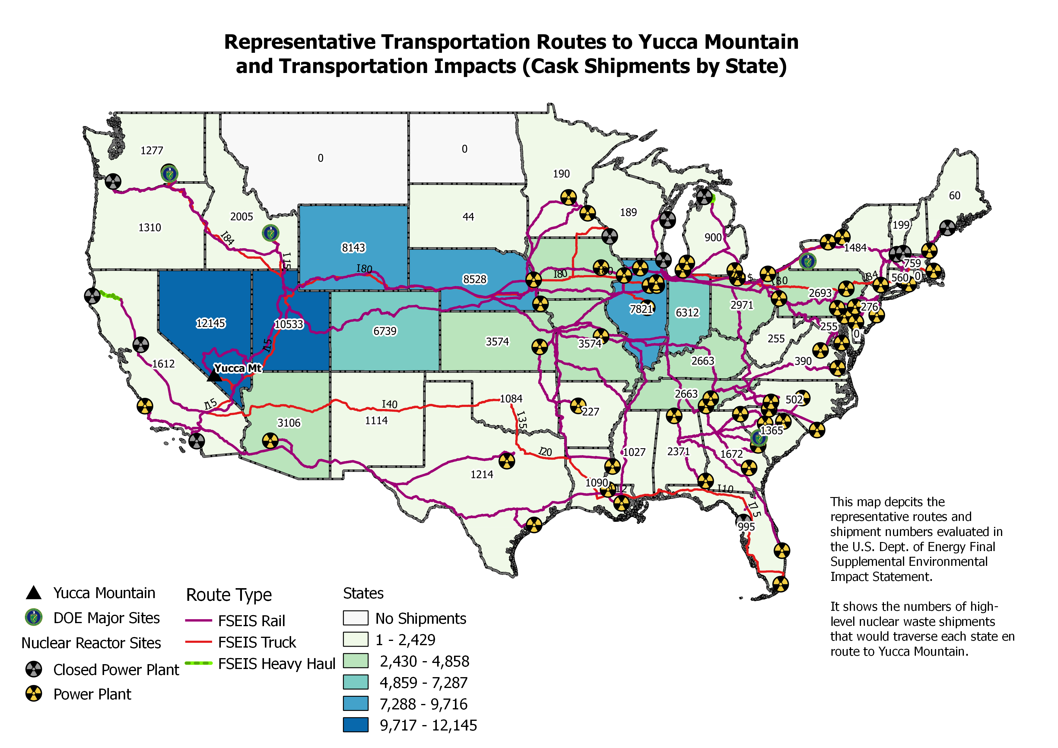
Representative Transportation Routes to Yucca Mountain and Transportation Impacts (Cask Shipments by State)
 Support documentation [29 Page PDF] Yucca Mountain
Transportation Issues, University of Nevada - Las Vegas, February 19, 2015 — Fred C. Dilger, PhD
Consultant for Nevada Agency for Nuclear Projects
Support documentation [29 Page PDF] Yucca Mountain
Transportation Issues, University of Nevada - Las Vegas, February 19, 2015 — Fred C. Dilger, PhD
Consultant for Nevada Agency for Nuclear Projects
|
 |
|
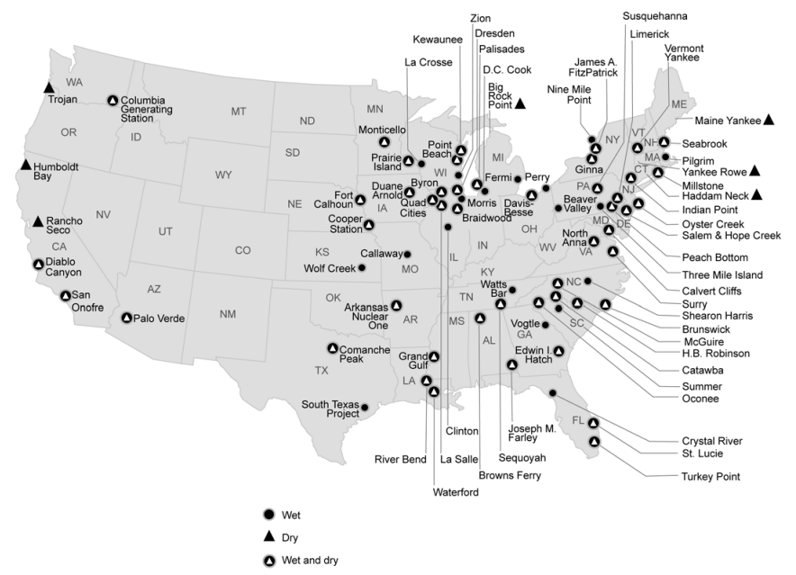
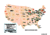
National Transportation:
Map of sites with spent nuclear fuel and High-Level Waste that would be transported to Yucca Mountain
|
 |
|
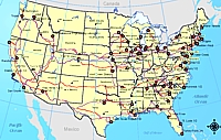
Potential Rail, Barge and Truck Routes to Yucca Mountain -- All States:
This is a national transportation map of potential rail, barge and truck routes to Yucca Mountain. In addition to the national map, there are links to individual state maps showing site specific in-state rail, barge and truck routes.
|  |
|
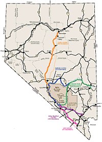
Nevada Map:
This Map shows potential rail routes to Yucca Mountain with in Nevada. This statewide rail map was produced by DOE - OCRWM for the Yucca Mountain Environmental Impact Statement.
As noted perviously on this website, in April 2004, DOE released a Record of Decision that officially selected Caliente as the preferred rail route to ship nuclear waste to Yucca Mountain. The Carlin route was chosen as a potential secondary route.
|  |
|