1. INTRODUCTION
1.1 Purpose and Scope
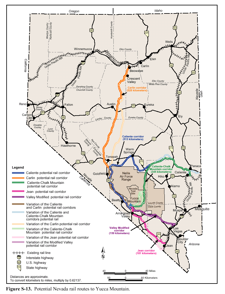
 he Department of Energy (DOE) has proposed to transport radioactive waste to the proposed repository at Yucca Mountain in Nye County using "mostly rail." The Department estimates that about 90 percent of shipments will be transported by rail, using a new corridor constructed through Nevada to the repository site. Ten percent of the waste will be shipped by truck, using the Interstate system. he Department of Energy (DOE) has proposed to transport radioactive waste to the proposed repository at Yucca Mountain in Nye County using "mostly rail." The Department estimates that about 90 percent of shipments will be transported by rail, using a new corridor constructed through Nevada to the repository site. Ten percent of the waste will be shipped by truck, using the Interstate system.
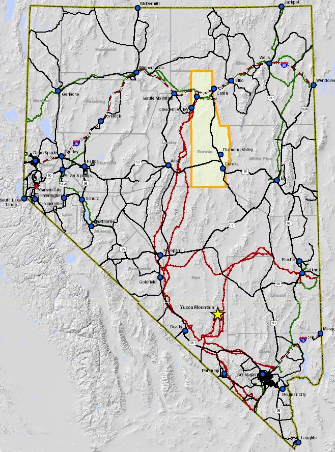
One of the proposed rail corridors to transport the waste, the "Carlin corridor," originates in northern Eureka County and extends approximately 24 miles within the county near the towns of Beowawe and Crescent valley. Interstate 80 runs east-west through the northern part of the county, roughly parallel to the Union Pacific mainline.
One of the potential impacts identified in the County's Impact Assessment Report was that activities of the Yucca Mountain repository project could impact mining, which is a major industry and economic driver in Eureka County. The County is preparing this mineral assessment report as an update to its Impact Assessment Report to gather baseline data and information related to the mineral activity and potential within Eureka County.
To prepare this report, research and review was conducted to gather information and data. Geographical Information System (GIS) analysis was conducted on the data to allow overlay of mineral features. The GIS work allowed the creation of maps instrumental in the preparation of this report.
1.2 Geographic Setting
Eureka County is located in east-central Nevada and encompasses 4,182 square miles. The county seat is Eureka, located in the southern part of the county. Climate in Eureka County is typical of the high desert Great Basin with warm summer days combined with cool summer nights. Winter brings cold temperatures with many nights below freezing. Mean annual rainfall in the county is just under eight inches.
Interstate 80 crosses the northern portion of the county, while U.S. Highway 50 crosses the southern portion of the county. State Route 278 runs north-south along the eastern side of the county. A major rail line crosses the northern portion of the county, generally paralleling Interstate 80.
|